What’s BACOG and How Do They Protect Your Water?
Learn How BACOG Facilitates Testing Water Quality, Mapping Aquifers, and More
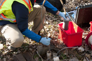 Have you heard of the Barrington Area Council of Governments, or BACOG? If you live in the greater Barrington, IL area, you may be benefitting from their work without even knowing it. They advocate for the needs of the local communities by conducting land use planning, legislative advocacy, environmental protection programs, emergency preparedness, training for local officials, and education for residents on topics like the health consequences of coal tar sealants. BACOG is particularly active in helping to safeguard our access to a clean, sustainable water supply. They pursue this goal by mapping aquifers, monitoring aquifer water levels, facilitating private well owners testing water quality, and conducting further research into the Barrington region’s water supply.
Since this organization helps monitor your water supply, learning about them is crucial to understanding your water. Let’s take a closer look at this group and the role they play in keeping your water safe and clean.
What Is BACOG?
You can probably gather some basic details about the Barrington Area Council of Governments from the name. This regional planning organization consists of the governments of six villages (Barrington, Barrington Hills, Lake Barrington, North Barrington, South Barrington and Tower Lakes) as well as two townships (Barrington and Cuba).
The group first formed on April 25, 1970 in response to growing development pressures. The members banded together to create a regional land use plan and to support development that would meet the goals of that plan. The BACOG member governments collaborate on finding solutions and implementing programs that provide the highest possible quality of life for the area’s residents. Their official mission is, “To foster cooperation and strategies to address regional challenges and support the comprehensive plan”.
BACOG operates under the direction of an Executive Board made up of the Village President or Township Supervisor of each village or township member. They’re advised by committees which carry out their mission in different ways. For example, the Legislative Committee develops an annual legislative platform that discusses the concerns and needs of the region. BACOG officials and staff then work with state and federal legislators to negotiate specific bills under their consideration. Also, a Water Resources Committee studies and recommends measures for protection of local water resources.
Other major components of BACOG’s work include emergency preparedness communications and exercises, training for local officials, and liaison with other planning efforts within the metro region.
Testing Water Quality, Mapping Aquifers, and Monitoring Wells
A large part of BACOG’s efforts go toward, as their homepage puts it, “Working together to protect our region’s resources.” What resource is more precious than water? That’s why BACOG helps conduct deep research into Barrington’s water supply through their Water Resources Initiative.
BACOG established a Water Resources Committee in 2001 that studies issues related to the Barrington area’s groundwater supply and educates residents on their source of water. This committee helps get out the word to private well owners about the need for testing water quality, because while municipalities are responsible for public water quality, the private well owner is the only party responsible for maintaining a safe, clean water supply for their home.
Aquifer Mapping and GIS
A Geographic Information System (GIS) is a tool that enables computer mapping and modeling of place-based information, whether on the ground surface (e.g., roads, water mains) or below ground. BACOG used GIS to analyze and build a 3-dimensional model of the shallow aquifer system, which is the source of water for 99% of residents in the area.
Illinois Water Utilities have been reporting some gross contaminants!
Check out the concerning contamination that has been reported by public water utilities in Illinois!

BACOG developed the model nearly 10 years ago, using in-house GIS work from BACOG and the scientific methodology developed by Dr. Kurt O. Thomsen, Ph.D., P.G., a hydrogeologist and environmental consultant. The State database of well driller logs was analyzed to classify underground soil materials into aquifer and non-aquifer units, in order to view the water below us.
Various maps and the 3-D model produced with GIS have been continually used to characterize and communicate information about the area’s groundwater. BACOG’s website and GIS map applicationshow municipal and township boundaries, the aquifer recharge areas, monitoring wells, stream gauges, and more. This makes it easier for governments and residents to identify their location in relation to groundwater characteristics and to apply those insights at a local or regional level.
Analyzing, Planning, Monitoring, and Educating About Groundwater
While research engenders a deeper knowledge and better understanding on the part of the public, the BACOG governments are taking it one step further. You have to apply what you learn. That’s why BACOG analyzes its research and then translates it into policy and planning recommendations. The Executive Board can utilize BACOG’s fact-based information and actual measurements to set new directions in groundwater protection.
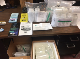
BACOG also works with private well owners and facilitates them testing water quality. They encourage the well owners to make a regular practice of testing for contaminants and educate them about proper well and septic system maintenance. BACOG also offers a different type of private well water testing that measures naturally-occurring groundwater chemistry, as the water comes out of the aquifers. BACOG then maps those test results (anonymously) to describe the area’s natural water quality.
Reports from the State of Illinois indicate a concern that shallow aquifer water levels in our area are declining. BACOG initiated a program to actively measure and monitor water levels in a network of 18 monitoring wells. With other measurements collected by BACOG from stream gages and municipal pumping wells, hydrogeologist Dr. Kurt Thomsen produced a baseline map of water levels in 2014. BACOG’s program continues to take measurements at regular intervals and will issue the next 5-year report in 2019, revealing any trends in water level changes. Monitoring will continue indefinitely, looking for trends over the coming decades. If problems are identified, BACOG’s fact-based maps and analyses will guide further action by both our governments and residents to protect the aquifers.
Additionally, BACOG has worked to build the community’s own understanding about water sustainability issues. For example, they created an educational video for local elementary school classrooms. This video explains the shallow aquifer system and where our area’s water comes from, how wells bring water into homes, where wastewater goes (septic or sewer), the groundwater replenishment/recharge process, the need for testing water quality, and what else can be done to protect groundwater.
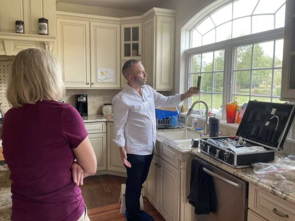
Defending your access to clean water is important. That’s why BACOG recommends you test your water. Angel Water has been performing water quality testing in Barrington, IL and the greater Chicago area for years, and is the leading water treatment company in the area. Give us a call at (847) 382-7800 and we’ll test your water for you and help you find your way to clean, healthy water!
Interested in a Water Softener System for Your Home?
You don’t have to live with a dry, itchy scalp and brittle hair anymore! It would be our pleasure to help you find the right water softener to make your showers enjoyable again.
Please give us a call at (847) 382-7800 or visit our water softener page to learn more.
